Kedarkantha Trek
India’s most stunning winter summit, made for first-timers and seasoned trekkers alike.
Kedarkantha Trek: Complete Overview
The one Himalayan summit where snow, forests, and a 360-degree panorama come together on a single trail. Kedarkantha stands at 12,500 feet inside the Govind Pashu Vihar National Park. The name means “Throat of Lord Shiva” in Sanskrit. The Swargarohini peaks, where the Pandavas climbed toward heaven, are visible from this summit.
We have walked every metre of the Sankri route across four seasons. Mapped every stream crossing. Documented every ridge where the peaks reveal themselves. This is not a summary pulled from other websites. This is the Kedarkantha trail as our team knows it: step by step, camp by camp, season by season.
What “Easy-Moderate” means in practice: most fit adults who can jog 5 km in 45 minutes and have done 2 to 3 months of regular cardio complete this trek without problems.
The Kedarkantha trail sits in a sweet spot that few Himalayan treks occupy. The altitude is high enough to deliver genuine summit views and snow camping. The trail gradient stays gentle enough for first-timers to handle without prior high-altitude experience. Among winter treks in Uttarakhand, this one has the best effort-to-reward ratio we have seen.
We recommend this trek for working professionals with limited leave days. The 5-day structure fits a Thursday-to-Monday window. Fly into Dehradun on Wednesday night, return by Monday evening. No buffer days needed if the weather holds.
If this is your first Himalayan trek, start with Kedarkantha. The trail teaches altitude, cold-weather camping, and summit-day discipline without pushing you into anything technical. After completing it, Brahmatal or Kashmir Great Lakes becomes a realistic next goal.
5 Reasons Kedarkantha Stands Apart
Click each reason to read the full story.
Between Sankri and Juda Ka Talab, about 2.4 km into the trail, the oak forest breaks open into a wide clearing. No signboard marks it. Most trip reports skip it entirely. But this is where the Kedarkantha trail first shows its hand.
We stopped here on a December morning and watched the Swargarohini massif fill the gap between two ridgelines. Morning frost caught early sunlight from the east. The only sound was a stream running 30 metres to the right. Too small to name on any map. The air carried that sharp pine resin smell that sticks to your jacket for days.
Most operators rush past this stretch. The camp at Juda Ka Talab is the goal. We build in a 15-minute halt here on every batch. First-time trekkers often say this clearing gave them their first Himalaya moment before the big views started.
Do not call the trail “forested” and leave it there. The forest shifts species four times across 1,850 metres of altitude gain.
The lower trail out of Sankri starts in dense Himalayan oak. Broad leaves create muted light on the forest floor. Around 2,300 metres, blue pine takes over from oak. The canopy opens. Sunlight hits the trail in patches. Resinous air replaces the damp smell of oak litter. Deodar cedar appears mixed with the pine. The Sanskrit name “deodar” means “timber of the gods.” Locals use it for temple construction across Uttarkashi.
Past 2,600 metres near Juda Ka Talab, silver birch appears. Birch bark peels white against dark soil. In winter, snow sits on the branches in clean horizontal lines. Wild strawberry and Pink Knotweed grow along the trail edges. Above the treeline past 3,200 metres, rhododendron scrub and alpine meadow take over. In spring, rhododendrons bloom red and pink alongside Drumstick Primrose and Himalayan Gentian.
The stretch between the pine zone and the birch zone is the most underrated section. Trekkers rush through it to get to the snow. That is a mistake.
Forget the word “panoramic.” Here is what you see from 12,500 feet, named and placed.
To the northeast, Swargarohini (6,252 m) rises with sharp snow ridges. “Ascent to Heaven.” The north face drops 2,000 metres in less than 2 km. That steepness is visible even from here.
Due east, the Bandarpoonch massif (6,316 m) dominates the skyline. “Monkey’s Tail.” Hanuman’s burning tail touched this summit. Tenzing Norgay summited this peak in 1950.
To the southeast, Kala Nag (6,387 m) stands dark against the snow. “Black Cobra.” Highest in the Bandarpunch massif. Behind it, the Gangotri group lines the horizon. Draupadi Ka Danda to the south-southeast. Jaonli further behind, identifiable by its flat summit on clear mornings.
Our trek leader Vikram points out each peak by name at the summit. Twenty minutes up there. Nobody speaks for the first thirty seconds. That silence after three days of walking defines the Kedarkantha summit.
Sankri is not a trailhead parking lot. It is a living Garhwali village at 6,400 feet where three rivers meet: the Supin, the Tons, and the Kedarganga. No motorable path exists beyond it. This is the last road into the Govind Pashu Vihar sanctuary.
The village has traditional wood-carved homes with slate roofs. Not Kinnauri style, but Garhwali. The Someshwar Mahadev temple sits at the village centre. Stone steps lead up through a narrow lane. Locals still perform daily aarti here. Shepherds tie sacred threads around trees before taking flocks to the high meadows. That custom runs generations deep.
We arrange a village walk for trekkers who arrive by afternoon. The walk covers the temple, the old market, and a viewpoint above the village where the Supin river valley drops away below. Try a Garhwali thali at a Sankri dhaba. Look for Jhangore Ki Kheer, Bhang Ki Chutney, and Gahat dal. These are Garhwali staples, not tourist dishes. Start the trek that way.
We cap every batch at 15 trekkers. Most operators on this route run batches of 25 to 40. The difference shows at every pinch point.
At the narrow oak forest section before the first stream crossing, a group of 30 creates a bottleneck. That adds 20 minutes to the day. On a busy January weekend, two large groups can mean 60 people on the summit ridge. Too many for a small space. We time our summit push to avoid overlap.
Our camp at Juda Ka Talab sits on the northern edge of the meadow, away from the main camping ground. Less noise at night. Better sunrise views in the morning. These details shape the entire experience.
Kedarkantha Trek: Detailed Day-by-Day Guide (Sankri Route)
| Day | Route | Distance | Duration | Start Alt | End Alt | Gain/Loss |
|---|---|---|---|---|---|---|
| 1 | Dehradun to Sankri (Drive) | 200 km | 9-10 hrs | 640 m | 1,950 m | +1,310 m (drive) |
| 2 | Sankri to Juda Ka Talab | 4 km | 4-5 hrs | 1,950 m | 2,700 m | +750 m |
| 3 | Juda Ka Talab to Base Camp | 3.5 km | 3-4 hrs | 2,700 m | 3,400 m | +700 m |
| 4 | Base Camp to Summit to JKT | 7.5 km | 6-7 hrs | 3,400 m | 2,700 m via 3,800 m | +400/-1,100 m |
| 5 | JKT to Sankri + Drive | 4 km + 200 km | 2.5 hrs + 9-10 hrs | 2,700 m | 640 m | -750 m (trek) |
Total trekking distance: 17.5 km across 4 trekking days. Total altitude gain: approximately 1,850 m from Sankri to summit. Total days: 3 trekking + 2 drive.
Do not underestimate this drive. The road from Dehradun to Sankri takes 9 to 10 hours. It crosses two major mountain passes and the tarmac quality drops sharply after Purola.
Pickup: Our team picks up trekkers at 6:00 AM from the Railway Station Road area in Dehradun. The convoy heads out through the Mussoorie bypass, not through Mussoorie proper. The bypass saves 45 minutes.
The road drops into the Yamuna valley toward Nainbag. From there it climbs again through Purola, the last town with reliable ATMs and a proper market.
ATM Warning
Withdraw cash in Dehradun or Purola. The last reliable ATMs are in Purola: SBI, ICICI, and Axis Bank. ATMs beyond Purola are often empty on weekends.
The stretch between Purola and Mori has the best valley views on the drive. Past Mori, the road narrows and enters the Tons river valley. The Tons carries more water than the Yamuna itself. Largest tributary, born from the Bandarpunch glacier. The final 30 km to Sankri runs along the Supin river on a single-lane road with sharp bends.
Key stops:
- Purola (approx. 5 hours from Dehradun): Lunch stop. Last ATM point. Last petrol pump before Sankri.
- Mori (approx. 7 hours): Short rest. Tea and snacks available.
The convoy reaches Sankri by late afternoon. The evening briefing covers trail plans, gear checks, and a trial run with trekking poles and backpacks. Dinner is dal, rice, roti, and a local sabzi. Sleep early. The trail starts tomorrow.
Winter Note
In winter (December to February), the road past Purola can have ice patches after dark. We schedule the drive to reach Sankri before sunset.
Season Tip
In January and February, carry a thermos of hot water for the last 3 hours. The vehicle heater works, but the cold seeps through windows on the narrow mountain road. Pre-monsoon months (May to June) occasionally bring landslide-related delays near Mori.
First Kedarkantha trekking day. We keep the distance short on purpose. Four kilometres of uphill walking through dense forest with 750 metres of altitude gain. The goal is letting your body adjust to mountain air before the bigger days ahead.
Trail Directions
Start from Sankri village at 8:30 AM. The trail begins at the forest gate on the eastern edge of the village. A Govind Pashu Vihar National Park signboard marks the start. Register your group at the gate and enter the treeline.
Trailhead to First Bridge (0.8 km, 20 minutes): The first 800 metres climb steadily through thick Himalayan oak. Dense canopy. Sunlight filters through in thin shafts. Wide enough for two people side by side. Packed dirt mixed with dry oak leaves underfoot. In winter, frost covers the ground until about 10 AM. Wear trekking shoes from the start.
First Bridge to Pine Transition (0.7 km, 20 minutes): At roughly 1 km from the trailhead, you cross a small wooden bridge over a seasonal stream. This stream runs full in spring but narrows to a trickle by November. Refill water here. The next reliable source is Juda Ka Talab, about 3 km ahead. Past the bridge, the trail steepens for 300 metres through rocky, uneven ground.
Pine Zone to the Clearing (0.9 km, 25 minutes): Around the 1.5 km mark, oak gives way to Himalayan blue pine. You notice this transition clearly. The canopy opens, the floor turns to pine needles, and the air smells sharper. More resinous. Deodar cedar grows alongside the pine. “Timber of the gods” in Sanskrit. The trail widens into a gradual incline. Listen for the Himalayan monal, Uttarakhand’s state bird. Metallic green crest, copper feathers. Marmots appear in the rocky clearings. Barking deer are heard more often than seen.
The Clearing (2.4 km mark): The forest opens into a broad clearing. Our first scheduled rest stop. From here, the Swargarohini peaks are visible to the northeast for the first time. Spend 10 to 15 minutes. Water and dry fruits.
Clearing to Birch Zone (1.0 km, 30 minutes): Past the clearing, the trail re-enters forest. Mixed zone of pine and silver birch. Birch trees start appearing around 2,500 metres, their white bark standing out against dark pine trunks. In winter, snow settles on birch branches in clean horizontal bands. The most photographed stretch on the route.
Final Approach to Juda Ka Talab (0.6 km, 25 minutes): The final kilometre steepens into a sustained climb through birch forest. The trail breaks out into the Juda Ka Talab meadow. The lake sits at the far end of a wide, flat clearing ringed by birch and pine.
Altitude Profile: Start: 1,950 m. End: 2,700 m. Gain: 750 m (2,460 ft). The first 2 km are moderate. The last 2 km steepen, especially the final approach.
Difficulty: Easiest trekking day on the route. The altitude gain spreads across 4 km. Strong trekkers finish in 3.5 hours. First-timers should plan 5 hours with rest stops.
Campsite: Juda Ka Talab (2,700 m)
Juda Ka Talab means “the lake of locks.” Legend says water droplets from Shiva’s matted hair formed this lake. In winter, it freezes solid. The ice turns smooth and milky white. Roughly 40 metres across, ringed by birch on three sides. Open meadow on the fourth. The campsite sits on flat ground, about 100 metres from the lake.
Clear nights bring the Milky Way directly overhead. No light pollution from any direction. Phone signal is weak to nonexistent here. Inform family before leaving Sankri.
Season Note
In winter, 4 to 8 inches of packed snow from the 2 km mark onward. The stream at the 1 km bridge may be partially frozen. In spring (March to April), snow melts below 2,400 metres and wildflowers appear on the forest floor. Autumn treks have dry trails, fallen leaves, and crisp cold air. Snow arrives only in late November.
The Kedarkantha trail crosses the treeline today. That single transition defines Day 3. You start in birch forest at 2,700 metres and finish in open alpine meadow at 3,400 metres. The sky opens. Peaks fill the horizon.
Trail Directions
Leave camp by 8:00 AM. The trail heads north, skirting the eastern edge of the lake.
Camp to Stream Crossing (1.0 km, 30 minutes): First 500 metres through dense birch forest on a narrow trail. Birch trees here grow shorter than below. Snow hangs heavy on shorter branches in winter. At about 1 km, a small stream crosses the trail. Last reliable water source before base camp. Refill all bottles. In winter, the stream runs under a thin ice shelf. Break the ice carefully to fill your bottle.
Stream to Treeline (0.8 km, 35 minutes): Past the stream, the trail begins short, steep switchbacks. The steepest sustained section on Day 3. The gradient increases sharply for roughly 600 metres. Underfoot, the trail shifts from soft forest soil to rocky terrain with loose stones. At about 1.8 km (around 3,000 metres), the birch trees thin out. The forest does not end suddenly. Birch shrinks to scrub height, then gives way to rhododendron bushes and alpine grass. Look back here for a wide view south toward the Supin valley. On clear days you can trace the road to Sankri far below.
Treeline to Open Meadow (1.0 km, 30 minutes): Above the treeline, the trail traverses open meadow. In winter, this is a continuous snowfield. Trail markers are not always visible under fresh snow. Stay with your trek leader through this section. Do not take shortcuts across the snowfield. In spring, this same meadow is covered in wild alpine flowers. Purple primula. Yellow potentilla dotting the grass.
Final Approach (0.7 km, 20 minutes): The final 700 metres cross open, undulating terrain. The gradient eases into rolling ground. Base camp appears ahead on a flat shelf. The summit ridge is visible directly to the north.
Altitude Profile: Start: 2,700 m. End: 3,400 m. Gain: 700 m (2,297 ft). The middle section (1 to 2 km) is steepest.
Difficulty: Moderate. The gain is similar to Day 2, but you are above 3,000 metres now. Some trekkers feel mild breathlessness on the steep switchbacks above the treeline. Walk slowly. Breathe deeply. Rest at the switchback turns. Strong trekkers: 3 hours. Allow 4 hours if adjusting to altitude.
Campsite: Kedarkantha Base Camp (3,400 m / 11,155 ft)
Base camp sits on a wide, flat meadow at 3,400 m. Open on all sides. No trees for wind shelter. On windy days, gusts come from the northwest. Musk deer and snow leopard live in this sanctuary. Rare sightings, but their tracks appear in fresh snow near camp.
From camp, the summit ridge is visible to the north. The summit is the rounded peak on the left end of the ridge. To the east, the Bandarpoonch group lines the horizon. The Tons River is born from its glaciers. Sunset turns the western sky orange and pink behind the ridgeline.
Phone signal: zero. We carry walkie-talkies for communication between camp and the summit team.
Season Note
In winter, the trail above the treeline is fully snow-covered. Snow depth: 1 to 3 feet depending on recent weather. Microspikes or gaiters are useful above 3,000 metres. In spring, snow recedes from meadow edges but the summit holds deep snow. Autumn treks: dry brown grass, frost in the mornings, no snow below 3,500 metres.
Kedarkantha summit day is the hardest day, the earliest start, and the biggest reward.
Pre-Dawn Start
Wake-up call: 2:30 AM. Departure: 3:30 AM. Tea and biscuits before departure. Breakfast happens after the summit, back at base camp or at Juda Ka Talab.
Temperature at departure in winter (December to January): -8 to -12 degrees Celsius. Spring (March to April): -2 to -5 degrees. Autumn (October to November): -3 to -6 degrees. Layer up before stepping out. Base layer, fleece, down jacket, windproof shell. Gloves from the start. Bare hands go numb in 5 minutes at these temperatures.
Headlamp is mandatory until approximately 5:30 AM. No trail reflectors. Your headlamp is the only light source.
The Summit Push
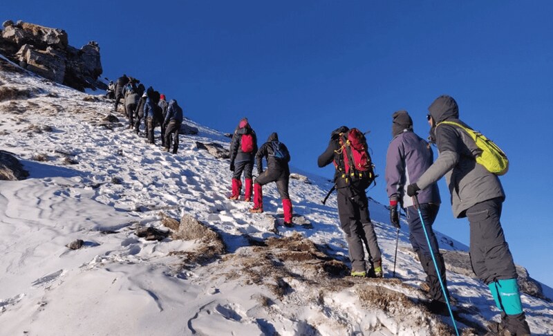
Base Camp to 3,600 m (1.5 km, 45-60 minutes): The trail heads directly north, climbing through snow in winter, loose scree in other seasons. The gradient stays moderate. Snow is firm in pre-dawn cold. Boots and microspikes grip well on packed snow.
3,600 m to Summit Ridge (0.5 km, 40-50 minutes): The gradient steepens significantly. This is the hardest 500 metres of the entire trek. Deep snow in winter, loose rock in other months. Short steps: plant your pole, step, breathe. Repeat.
Sunrise: First light hits the Bandarpoonch peaks, turning them gold against dark blue sky. The most photographed moment. Keep your camera accessible but do not stop long. The summit is still 30 to 40 minutes away.
Summit Ridge to Peak (300 m, 20-30 minutes): The trail crosses a broad snow slope that narrows into a ridge approach. Follow your trek leader’s exact footsteps. Do not walk to the edges.
Total summit push duration: 2 to 2.5 hours from base camp. Strong trekkers: 1.5 hours. We set a group pace to keep everyone together.
At the Summit: 12,467 ft / 3,800 m
The summit is a rounded peak with flat space for 15 to 20 people. We spend 20 to 25 minutes at the top.
What you see, named and placed:
- Northeast: Swargarohini (6,252 m). Sharpest ridgeline on the horizon.
- East: Bandarpoonch (6,316 m). Dominates the skyline.
- Southeast: Kalanag (6,387 m). Darkest peak in sight.
- South-Southeast: Draupadi Ka Danda (5,670 m). Ridgeline drops then rises.
- South: The Gangotri group. Distant but clear on good mornings.
- South-Southwest: Jaonli (6,632 m). Furthest visible peak. Flat summit.
Wind Warning
Wind at the summit:Winter: sustained 20 to 30 km/h with gusts to 50 km/h. Wind chill pushes felt temperature to -18 degrees or lower. Wear balaclava and windproof jacket. Exposed skin chills fast.
Descent to Juda Ka Talab
Summit to base camp: 1 to 1.5 hours, same trail reversed. In winter, snow softens by mid-morning. Steps firm on the way up may slide on the way down. Lean into the slope. Short steps. Let heels dig in.
Back at base camp, the team packs tents while trekkers eat hot breakfast. Descent from base camp to Juda Ka Talab follows the Day 3 trail in reverse. Another 1.5 to 2 hours.
Total Day 4: 6 to 7 hours of active trekking, plus rest stops and summit time.
Campsite: Juda Ka Talab (return) or Hargaon (alternate descent)
Campsite Note
Some operators use Hargaon as the descent campsite instead of returning to Juda Ka Talab. Hargaon sits at 2,700 m (8,900 ft), an open grassland encircled by dense pine and oak forest. It is part of the Govind Wildlife Sanctuary on a different trail arm from the ascent route. We use the Juda Ka Talab return for consistency. Trekkers who have done this Kedarkantha route before can request the Hargaon descent. Different trail, different views.
At Juda Ka Talab, the team has a second set of tents pitched. Afternoon is free for rest, a walk to the lake, or sitting quietly. Dinner served early. Tomorrow is the final day.
Season Note
After fresh snowfall, the trail above 3,600 metres may have knee-deep powder. We carry snow poles to test depth ahead of the group. Spring: patchy snow mixed with rock on the summit approach. Autumn: clearest visibility, coldest temperatures at the top.
All downhill on the Kedarkantha descent. All forward motion. Pack up, descend to Sankri, drive back to Dehradun.
Trail: Leave Juda Ka Talab by 7:00 AM. Retrace the Day 2 route. Four kilometres of steady descent through birch, pine, then oak forest back to Sankri.
The descent takes 2 to 2.5 hours for most trekkers. The trail is easier to navigate downhill, but knees take the load now. Tighten trekking pole straps and shorten poles by 5 to 10 cm. Land on toes, not heels, through steep sections.
Refill water at the stream crossing at the 3 km mark. The final kilometre into Sankri is a gentle walk-through familiar oak forest.
Drive: Sankri to Mori to Purola to Nainbag to Dehradun. Expect 9 to 10 hours. Do not book return flights from Dehradun before 9:00 PM. Mountain road delays happen, especially in winter when roads near Purola ice over after dark.
How Difficult Is the Kedarkantha Trek: Honest Assessment
Most first-timers overthink the Kedarkantha difficulty. The trail is doable for people with basic fitness. But doable does not mean easy. Honesty here saves trouble on the trail.
Three of five Kedarkantha days involve actual trekking. Days 2 and 3 are steady uphill walks on well-marked trails through dense forest. The footing is packed dirt and rock, shifting to snow above 2,500 metres in winter.
Day 4 is where the Kedarkantha terrain tests you. The summit push gains 400 metres (1,300 ft) in 2 km. The steepest gradient sits between 3,600 and 3,750 metres. In winter, packed snow angled at 30 to 35 degrees. We provide microspikes for all trekkers during December to March. Ice patches form on exposed rock above 3,500 metres after January. Walk slowly. Test each step before shifting weight.
The Kedarkantha descent on Day 4 covers 1,100 metres of altitude loss in a single stretch. Knee strain is the most common complaint. Trekking poles reduce knee load by 25 to 30 percent on descents. Use them.
Kedarkantha summit day total: 5 hours of climbing, 2 to 3 hours of descent. Plan for 7 hours on your feet.
| Location | Winter (Dec-Feb) Day/Night | Spring (Mar-Apr) Day/Night | Summer (May-Jun) Day/Night | Autumn (Oct-Nov) Day/Night |
|---|---|---|---|---|
| Sankri (1,950 m) | 8-12°C / 0 to -3°C | 15-20°C / 3-6°C | 20-25°C / 8-12°C | 12-18°C / 2-5°C |
| Juda Ka Talab (2,700 m) | 0-3°C / -8 to -12°C | 5-10°C / -3 to -6°C | 10-18°C / 0-5°C | 8-12°C / -3 to -5°C |
| Base Camp (3,400 m) | -2 to 0°C / -12 to -15°C | 2-6°C / -5 to -8°C | 8-14°C / -2 to 2°C | 5-8°C / -6 to -8°C |
| Summit (3,800 m) | -8 to -12°C (wind chill: -18 to -25°C) | -2 to -5°C | 2-6°C | -3 to -6°C |
Wind chill on summit day pushes felt temperature 8 to 10 degrees lower than the thermometer. Four layers minimum for the winter summit push: base layer, fleece, down jacket, windproof shell.
Weather on the Kedarkantha route changes fast above the treeline. A clear morning at base camp can turn to cloud and light snow by afternoon. In pre-monsoon months (May to June), afternoon thunderstorms are possible above 3,000 metres.
Total altitude gain on the trek: 1,850 metres (6,070 feet) from Sankri to summit. The highest camp is at 3,400 metres. The summit reaches 3,800 metres.
Acute Mountain Sickness risk begins above 2,500 metres for most people. The itinerary is built for natural acclimatization. Day 2 gains 750 metres. Day 3 gains 700 metres. Day 4 gains 400 metres to the summit, then descends 1,100 metres. Climb high, sleep low.
We carry pulse oximeters and check SpO2 at every camp. If oxygen saturation drops below 80 percent, we begin descent. Portable oxygen cylinders are stationed at Juda Ka Talab and base camp. Our trek leaders carry oximeters, first aid kits, and emergency medication on their person at all times.
Guide-to-trekker ratio: 1 guide for every 5 trekkers. Every batch has a minimum of one certified trek leader and two support guides.
- From Juda Ka Talab (Day 2 camp): 4 km descent to Sankri. 2 to 2.5 hours with a guide.
- From Base Camp (Day 3 camp): 7.5 km to Sankri via Juda Ka Talab. About 4 to 5 hours.
- From the summit trail (Day 4): Return to base camp first (1 to 2 hours), then guided descent to Sankri.
Nearest medical facilities:
- For minor issues: Primary Health Centre in Mori, approximately 3 hours from Sankri by road.
- For serious emergencies: District Hospital Uttarkashi, approximately 5 hours. Civil Hospital Dehradun, 9 to 10 hours.
Communication equipment: Walkie-talkies between all camp teams and summit groups. No satellite phone currently. Mobile signal available in Sankri only (BSNL, intermittent Jio).
Best Time to Do the Kedarkantha Trek: Season by Season
The best time for the Kedarkantha Trek is from December through February, when the trail is covered in snow. March and April bring snow at higher elevations, with wildflowers blooming below. October and November offer some of the clearest mountain views of the year.
This is the Kedarkantha season most people picture. Deep snow from 2,500 metres upward. Frozen lake at Juda Ka Talab. The summit approach covered in white.
Temperatures: Daytime at Juda Ka Talab: 0 to 3 degrees. Nights: -8 to -12 degrees. At base camp, nights hit -12 to -15 degrees in January. Summit at 3 AM feels like -15 to -25 degrees with wind chill. Five warm layers needed for the summit push.
Snow conditions: Snow settles above 2,500 metres by mid-December. By January, the trail from the 2 km mark has 4 to 12 inches of packed snow. Summit approach: 1 to 3 feet. We provide microspikes for all winter trekkers.
The oak forest below Juda Ka Talab carries snow on every branch. The birch zone looks like a black-and-white photograph. Above the treeline, white against blue sky.
Crowd levels: December 24 to January 5 is the busiest window. Every batch sells out. Mid-January to mid-February is quieter with deeper snow and fewer people on the summit ridge. We recommend the second and third weeks of January for the best balance of snow depth and trail solitude.
Recommended for: First-time snow trekkers who want guaranteed white landscapes. Cold-weather camping enthusiasts. Photographers chasing winter mountain light.
Best of both worlds on the Kedarkantha route. Snow still covers the upper sections and summit. Below 3,000 metres, the forest wakes up. Wildflowers appear. The frozen lake at Juda Ka Talab shows cracks by late March.
Temperatures: Daytime at Juda Ka Talab: 5 to 10 degrees. Nights: -3 to -6 degrees. Base camp nights: -5 to -8 degrees. Summit push is cold but not brutal. Expect -5 to -10 degrees at the top. Four warm layers for the summit.
Snow conditions: Snow recedes from the lower trail first. By mid-March, Sankri to Juda Ka Talab is mostly clear. Above the treeline, snow holds until mid-April. The summit has firm snow through April most years.
The wildflower bloom: Between 2,800 and 3,200 metres, rhododendrons flower in red and deep pink. Below them, wildflowers appear from late March: yellow Himalayan Flax, purple Drumstick Primrose, Gentian, Pink Knotweed, and wild strawberry along the birch edges. Colour against remaining snow. Winter and autumn cannot match this contrast.
Crowd levels: March sees moderate Kedarkantha crowds. April fewer trekkers. Spring is underrated. We think it offers the best overall experience of any season.
Recommended for: Trekkers who want summit snow without extreme cold. Flower enthusiasts. People who prefer milder nights at camp.
The snow is gone from the lower trail. Meadows above the treeline turn green. A different Kedarkantha experience from the winter version. Not a lesser one.
Temperatures: Pleasant days at all camps. 10 to 18 degrees during the day. 0 to 5 degrees at night up to base camp. Summit is cool but not freezing. Two warm layers sufficient.
Trail conditions: Dry trails. Clear streams. Green forest. The birch canopy is full and the forest floor is lush. Snow remains on the summit in early May. Gone by late May most years. June brings pre-monsoon moisture. Expect afternoon clouds and occasional rain above 2,500 metres by mid-June.
Crowd levels: Low. Summer is the off-season. If solitude matters more than snow, this is the window.
Recommended for: Trekkers who prefer warmth and green landscapes. Those avoiding snow. Budget-conscious trekkers (off-peak pricing available).
The photographers’ season on the Kedarkantha trail. The air clears after monsoon. Mountain visibility reaches its annual peak.
Temperatures: Crisp, cool days. 8 to 12 degrees at Juda Ka Talab during the day. -3 to -5 at night. Base camp nights: -6 to -8 degrees in November. Summit push is cold but not extreme. Four warm layers.
Trail conditions: Dry trails. No snow below 3,500 metres in October. First snowfall usually arrives late November.
Forest colours: Birch leaves turn yellow. Oak shifts to brown and red. Pine stays green. The contrast between yellow birch and green pine creates strong colour bands on the hillside.
Crowd levels: October Kedarkantha crowds are moderate. Last two weeks of November sell out fast as trekkers chase early snow.
Recommended for: Photographers wanting crystal-clear mountain views. Trekkers who prefer cool but not freezing conditions. People who want dry trails with autumn colour.
How to Reach Kedarkantha Trek: Complete Travel Guide
Getting to Sankri is the first real step of the Kedarkantha trek. Sankri sits 200 km from Dehradun on a mountain road that does not forgive bad planning.
By flight: Delhi to Dehradun (Jolly Grant Airport). Roughly 1 hour. Multiple airlines daily. Tickets: 3,000 to 6,000 rupees. Book 3 weeks early for best rates.
By train: Three trains work well. Nanda Devi Express (12206) departs Delhi at night, arrives Dehradun early morning. Dehradun Shatabdi (12018) runs daytime, 5.5 hours. Mussoorie Express (14042) is slower but cheaper. All arrive at Dehradun Railway Station.
By bus: Overnight buses from Delhi ISBT Kashmere Gate to Dehradun. 6 to 7 hours. Volvo AC buses leave between 9 PM and 11 PM. Tickets: 600 to 1,200 rupees.
Pro Tip
If the price gap between a Delhi-Dehradun flight and an overnight bus is under 1,500 rupees, fly. You arrive rested and save 6 hours. We have seen trekkers arrive exhausted from the bus and struggle on Day 2.
Direct flight: Mumbai to Dehradun. About 2 hours 15 minutes. IndiGo and SpiceJet daily. Prices: 4,000 to 8,000 rupees. Book 3 to 4 weeks early.
Flight plus train: Mumbai to Delhi (2 hours), then Shatabdi or overnight train to Dehradun. Cheaper when direct flights are priced high.
Direct flight: Bangalore to Dehradun. 2.5 to 3 hours. IndiGo runs daily. Prices: 5,000 to 10,000 rupees.
Via Delhi: Bangalore to Delhi (2.5 hours), then onward to Dehradun. Often cheaper. Plan arrival in Dehradun by evening before trek start.
This 200 km drive takes 9 to 10 hours. The last 60 km is narrow, winding, shared with local traffic.
The route: Dehradun to Mussoorie bypass to Nainbag to Purola to Mori to Netwar to Sankri. Some operators go through Mussoorie proper. We take the bypass. Saves 45 minutes.
Key stops:
- Purola (approx. 5 hours from Dehradun): Lunch stop. Last proper town. Last reliable ATMs: SBI, ICICI, and Axis Bank in Purola. Withdraw here if you missed Dehradun.
- Mori (approx. 7 hours): Short rest. Tea available. SBI ATM here but often empty on weekends.
By public bus: Buses leave from Dehradun Hill Bus Stand (NOT ISBT). Many trekkers go to the wrong stand and miss the bus. Morning departures: around 5 AM, 6 AM (private), and 8 AM (government). Journey: 9 to 10 hours. Fare: 400 to 600 rupees.
Road Conditions
Roads past Purola can have ice patches in January and February. The Mori stretch is the narrowest. Pre-monsoon (May to June) brings occasional minor slides near Mori. We schedule drives to avoid driving these sections after dark.
Sankri village: A small Garhwali village at 6,400 feet. Slate-roofed wooden houses along a narrow main road. Phone signal: BSNL and Jio, intermittent. No petrol pump. Nearest fuel is Purola. A few basic shops sell snacks, batteries, and rain covers.
Do not book return flights or trains before 9:00 PM. Mountain road delays are common. Book late-evening flights or next-morning departures for safety. If taking an overnight bus to Delhi, keep enough buffer time. We recommend flights from Dehradun only after 10 PM, or next-morning departures.
In Sankri (night before Day 2): Two to three guesthouses near the main road. Basic rooms with blankets. Rates: 500 to 1,000 rupees per night. Meals available. Phone charging possible. Hot water on request.
In Dehradun (night before Day 1): Stay near the pickup point area or Railway Station Road. Budget hotels: 800 to 1,500 rupees per night. Restaurants open late for dinner. ATMs within walking distance.
In Dehradun (after the trek): Do not plan same-night long-distance departures after the Kedarkantha trek. You will be tired and likely delayed. Book a room near the bus stand or railway station for the night. Depart next morning.
What the Kedarkantha Trek Experience Is Like: Camps, Food, Stay
Three nights in tents at two Kedarkantha campsites. Hot meals at every stop. The camps are not luxury. They are well-organized mountain bases built for rest, warmth, and fuel between trekking days.
Two trekkers share each tent. We use four-season dome tents rated for high-altitude wind. Foam mattresses and sleeping bags are provided. Sleeping bag rating: comfort to -10 degrees Celsius. Bring your own fleece liner if you sleep cold.
At Juda Ka Talab, tents sit on flat meadow surrounded by birch trees. The tree cover provides some wind buffer. At base camp (3,400 m), the site is open alpine meadow. No trees. Base camp is colder and windier than Juda Ka Talab. Wear fleece and socks inside the sleeping bag.
We carry a spare tent on every batch. If a tent pole snaps or a zipper fails, the backup is pitched within 15 minutes. Our Kedarkantha ground team, led by camp manager Dinesh, sets up camp before the trekking group arrives. By the time you walk into camp, tents are pitched, the kitchen is running, and soup is 20 minutes away.
Meals follow a fixed schedule, cooked fresh at every camp by our kitchen team of three.
- Breakfast: Parathas with butter, poha or upma, boiled eggs (on request), tea and coffee.
- Lunch: Packed on trekking days. Paratha wraps, fruit, energy bars, juice box.
- Evening snack: Soup, biscuits, tea or hot chocolate. Soup is served within 20 minutes of reaching camp. Non-negotiable in our operations. Hot liquid after cold trail hours matters.
- Dinner: Dal, rice, roti, two vegetable dishes, pickle. Occasional treats: rajma, mixed dal, paneer (when supply allows).
Dietary needs: Vegetarian is the default. Jain meals (no onion, no garlic) available with 7 days advance notice. Vegan options possible with prior request.
The food on the Kedarkantha trail is simple, hot, and generous. Do not expect restaurant variety at 3,400 metres. Expect food that fuels you for the next day.
Portable toilet tents at both campsites. Bio-degradable waste pits dug at each site and covered before departure. We follow a strict leave-no-trace policy. All non-biodegradable waste is carried out in sealed eco bags.
No shower facilities on the trail. Carry biodegradable wet wipes for daily freshening. Washing water is available at stream sources near both camps.
5:30 AM: Wake-up call. Hot tea delivered to your tent.
6:00 AM: Wash up. Pack sleeping bag and personal items.
7:00 AM: Breakfast at the mess tent.
7:45 AM: Trek briefing from the trek leader. Trail plan, weather update, pace expectations.
8:00-8:30 AM: Start trekking.
12:00-1:00 PM: Packed lunch on the trail (Days 2 and 3) or arrival at next camp.
2:00 PM: Arrive at camp.
2:30 PM: Soup and snacks.
3:00-5:00 PM: Free time. Rest, explore, photograph.
6:30 PM: Dinner.
8:00 PM: Lights out.
This rhythm repeats for all three Kedarkantha trekking days. Summit day (Day 4) is different: 2:30 AM wake-up, 3:30 AM departure, breakfast after descent.
Kedarkantha Trek Packing List: What to Carry
Pack wrong for the Kedarkantha trail and you either freeze or carry dead weight for five days. Temperatures swing from 8 degrees to -15 degrees within the same 24 hours. Layering is the entire strategy.
Clothing: The Layering System
Layering on the Kedarkantha route works because it traps warm air in thin pockets between fabrics. One thick jacket cannot do what three thin layers can. You add layers when cold, strip layers when warm. That flexibility is the point.
Layering
- Base layer: Thermals (top and bottom). Synthetic or merino wool. Cotton absorbs sweat and kills warmth. Wear thermals from Day 2 onward.
- Mid layer: Fleece jacket or light down. This traps body heat.
- Outer layer: Windproof and waterproof shell jacket. Sealed seams and a hood that cinches tight.
- Winter (Dec-Feb): 5 layers for summit day. Base + thermal + fleece + down jacket + windproof shell.
- Autumn (Oct-Nov): 4 layers.
- Spring (Mar-Apr): 3 to 4 layers.
- Summer (May-Jun): 2 to 3 layers.
- 3 pairs trekking socks (wool blend)
- 2 pairs thermal gloves (one liner, one insulated)
- One balaclava or neck gaiter
- One warm beanie
Footwear
- Trekking shoes: Ankle-high, waterproof, stiff soles, good grip. Break them in for at least 2 weeks before departure. New shoes cause blisters by Day 2.
- Camp shoes: Lightweight sandals for camp. Your feet need air after 5 hours in boots.
- Gaiters: Useful in winter (December to March) to keep snow out of boots.
Gear
- Trekking poles: Not optional. Poles reduce knee strain by 25 to 30 percent on descents. We can provide rental poles at Sankri.
- Headlamp: Mandatory. Summit day starts at 3 AM. Carry spare batteries in a warm pocket.
- Sunglasses: UV-rated Category 3 or 4. Snow reflects UV light at altitude. Snow blindness is a real risk above 10,000 feet on clear days.
- Rain cover: For your backpack. Sudden afternoon rain happens in spring and pre-monsoon months.
- Power bank: Minimum 10,000 mAh. Keep inside your sleeping bag at night. Lithium batteries drain fast below zero. Charging is not available on the trail.
Personal Essentials
- Sunscreen SPF 50+. UV at 12,000 feet is 40 percent stronger than at sea level. Reapply every 3 hours on summit day.
- Lip balm with SPF. Cracked lips at altitude are painful and slow to heal.
- Toiletries: Biodegradable soap and shampoo only.
- Personal medication: Carry your own prescriptions plus paracetamol, Imodium, ORS packets, band-aids, and blister pads.
What NOT to Carry
Heavy jeans or cotton clothing. Cotton absorbs sweat and refuses to dry at altitude. This is how hypothermia starts.
More than 8 to 9 kg total backpack weight. If your bag is heavier, use our offloading service. Carry a daypack with water, snacks, sunscreen, rain cover, and a warm layer. Leave the rest.
Items to leave at Sankri: Extra clothes, city shoes, laptop. We have a cloakroom at Sankri base. First bag free. Additional bags: 500 rupees each.
How to Get Fit for the Kedarkantha Trek
Start training 6 weeks before your Kedarkantha trek date. Not 6 days. Six weeks, three to four sessions per week. Our fitness plan was designed by our senior trek leader Vikram, who has led over 80 batches on this route across 6 years.
The Fitness Benchmark
Run this test tomorrow. If you pass all three, you are ready for the Kedarkantha trail.
If you cannot clear these right now, you have 6 weeks. That is enough. Follow the plan below.
Weeks 1-2: Base building. Walk 3 km daily at a brisk pace. Add 10 minutes of stair climbing after the walk. Three sessions per week. Focus on consistent daily movement, not intensity.
Weeks 3-4: Add load and incline. Increase daily walk to 5 km. Add a 5 kg backpack to your walks. Build stair climbing to 15 floors without stopping. Add bodyweight squats: 3 sets of 10. Four sessions per week.
Weeks 5-6: Trek simulation. Walk 5 km with an 8 kg backpack at a brisk pace. Complete 20 floors of stair climbing with the same pack. Add calf raises: 3 sets of 15. Jog 2 km at the start of every session. Four sessions per week.
Pre-trek fitness check: We ask trekkers to share 2 screenshots of their walking/jogging activity from any fitness app (Strava, Google Fit, Apple Health) 15 days before the trek date. Not a pass/fail gate. It helps our trek leader plan the pace for each batch.
Be honest with yourself. Our trek leader may advise you to turn back at base camp or earlier if you fall behind the group by more than 45 minutes consistently. A safety decision. At altitude, a trekker who cannot maintain minimum pace becomes a risk for the entire group.
We would rather you come back next season fully prepared than push through and risk your health. Full trek fee credit applies for fitness-related turnarounds on our recommendation.
Trekkers above 55: Medical fitness certificate required. A treadmill test report from within 3 months of trek date is recommended.
Children: Minimum age 8. Must be accompanied by a parent or guardian. Children under 14 are exempt from the fitness screenshot requirement but must meet the stair-climbing benchmark.
Pregnant women: We do not recommend this trek during pregnancy. The altitude, cold, and exertion pose risks we cannot manage adequately on the trail.
Asthma or heart conditions: Share full medical history before booking. We may ask for a doctor’s clearance letter. Trekkers with controlled asthma have completed this trek successfully, but we need to know in advance for medication and emergency planning.
Kedarkantha Trek Cost: Complete Pricing Breakdown
No ranges. No “starting from” estimates. Here is the exact cost.
| Component | Cost (Per Person) | Notes |
|---|---|---|
| Trek fee (Dehradun to Dehradun) | Rs 7,500 | Includes transport, meals, camping, guides, permits, medical kit |
| Backpack offloading | Rs 1,600 + GST | Optional. Max 12 kg per bag |
| Cloakroom at Sankri | Free (1 bag) / Rs 500 per extra bag | Store city luggage during trek |
| Trek insurance | Rs 350 | Mandatory. Covers emergency evacuation |
Total minimum cost: Rs 7,850 per person (trek fee + insurance). Offloading and cloakroom are optional.
What Is Included
- Dehradun to Sankri to Dehradun transport (both ways)
- All meals from Day 1 dinner to Day 5 lunch
- Camping at Juda Ka Talab and base camp: tents, sleeping bags, mattresses
- Trek leaders and support staff
- Forest permits and camping fees
- First aid kit and basic medical supplies
- Microspikes in winter
- Portable oxygen at high camps
What Is Not Included
- Travel to and from Dehradun (flights/trains/buses)
- Personal trekking gear (shoes, backpack, clothing)
- Personal medication beyond basic first aid
- Tips for trek staff
- Meals and accommodation in Dehradun before and after the trek
Travel to Dehradun: 3,000 to 8,000 rupees depending on your city and travel mode.
Personal gear (if buying new): 3,000 to 6,000 rupees for shoes, thermals, and a fleece.
Dehradun hotel (night before or after): 800 to 1,500 rupees per night.
Tips for trek staff: 300 to 500 rupees per trekker is common practice.
Budget Rs 4,000 to 5,500 above the trek fee for travel to Dehradun, gear, and personal expenses.
We do not compete on Kedarkantha trek price. Budget operators cut costs on food quality, tent condition, and guide training. We cut costs nowhere. A 1:5 guide ratio costs more than 1:15. Four-season tents cost more than single-season ones. Fresh-cooked meals at 3,400 metres cost more than pre-packed food. That is where your money goes.
| When You Cancel | Refund |
|---|---|
| 30+ days before trek date | 75% refund |
| 15-29 days before trek date | 50% refund |
| 7-14 days before trek date | 25% refund |
| Less than 7 days before trek date | No refund |
Refund processing time: 7 to 10 business days from cancellation confirmation.
If WE cancel due to weather, safety, or government restrictions: full refund or free reschedule to any available date within 12 months. Your choice.
Reschedule option: If you cannot make your booked date, you may reschedule once to any available date in the same season at no extra charge. Requests must come at least 15 days before original trek date.
Trek Safety Terms: Our rule: if the risk of proceeding exceeds the cost of turning back, we turn back. No Kedarkantha summit is worth a life. No photograph is worth an injury.
Our trek leader has final authority on all trail decisions. This includes turning back the group in bad weather, refusing summit push in unsafe conditions, and sending individual trekkers back to a lower camp if their fitness or health does not allow safe continuation.
Behaviour policy: No smoking on the trail. No alcohol during the trek. No littering. Violation of any of these results in removal from the group without refund.
Your Protection: Trek insurance (Rs 350, mandatory) covers emergency evacuation from any point on the trail to the nearest motorable road. It does not cover pre-existing medical conditions or personal gear loss. For full travel insurance covering trip cancellation, medical issues, and gear loss, purchase a separate policy before departure.
Dehradun to Dehradun
Dehradun to Dehradun
(Transportation Included)
Upcoming Batches

“I started Kedarkantha Trek because the mountains changed my life, and I wanted to make that transformation accessible to anyone willing to walk. Every trail we run, I ask: would I send my own family on this batch?”
Ritesh Mishra
Founder, kedarkanthatrek.in • 12 years in Himalayan trekking
What Trekkers Say About the Kedarkantha Trek
Aggregate Rating: 4.8 / 5 (based on 127 verified reviews). These are unedited accounts from trekkers who completed the Kedarkantha trek with us. Names and details shared with permission.
Kedarkantha Trek: Frequently Asked Questions
Is the Kedarkantha Trek difficult?
The Kedarkantha Trek is considered an easy to moderate trek. Beginners can complete it with basic fitness preparation. The trail has gradual climbs, scenic forests, and snowy stretches in winter. A little stamina and good footwear make the journey comfortable.
How long is the Kedarkantha Trek?
The trek usually takes around 5 days to complete. The total distance is about 17.5 kms. It includes daily walks of four to six hours, depending on the pace and weather.
How much does a Kedarkantha Trek cost?
The average cost of the Kedarkantha Trek ranges from ₹6,000 to ₹10,000 per person. The price depends on the trek package, inclusions, and group size. Some premium packages also include transport and better campsites.
What is Kedarkantha trek famous for?
Kedarkantha is famous for its snow-covered peaks and 360-degree Himalayan views. The summit offers a stunning sunrise and panoramic view of nearby ranges. It is also known for peaceful campsites and dense pine forests.
Which month is best for the Kedarkantha Trek?
The best months for the Kedarkantha Trek are December to April. During these months, trekkers can enjoy fresh snow and clear skies. Spring offers pleasant weather, while winter adds a magical white cover to the trail.
Are there any risks during Kedarkantha trek?
The trek is generally safe, but weather can change suddenly in the mountains. Slippery snow paths or cold winds can pose small risks. Proper gear, warm clothing, and following guide instructions help avoid issues.
Which is the toughest trek in Uttarakhand?
Many trekkers find the Kalindi Khal and Nanda Devi treks the toughest in Uttarakhand. They are high-altitude expeditions that need good experience and fitness. Compared to them, Kedarkantha is much easier and beginner-friendly.
Which city is near to Kedarkantha?
Dehradun is the nearest major city to Kedarkantha. It is well-connected by flights, trains, and buses. From Dehradun, trekkers usually travel to Sankri, the base village of the trek.
How do I go from Dehradun to Sankri?
You can reach Sankri from Dehradun by road. Shared taxis and local buses run daily from Dehradun to Sankri. The journey takes about eight to nine hours and passes through scenic mountain roads.
What is the temperature in Kedarkantha in January?
In January, Kedarkantha experiences very cold weather. Daytime temperatures stay around 5°C to 8°C, while nights drop below freezing. Warm jackets, gloves, and layered clothing are necessary during this month.
Which God is Kedarkantha?
Kedarkantha is believed to be linked to Lord Shiva. Local legends say Shiva once meditated on this mountain. The name “Kedarkantha” means “throat of Lord Kedar,” another name for Lord Shiva. Many locals consider the peak a sacred place.
Can a beginner do Kedarkantha trek?
Yes, beginners can easily do the Kedarkantha Trek. The route is well-marked and not too steep. With basic fitness and preparation, anyone can complete it safely. Local guides help ensure the journey stays easy and enjoyable.
Which is the scariest trek in India?
The Stok Kangri and Kalindi Khal treks are often called the scariest in India. These routes have extreme altitudes and tough terrain. They are meant only for experienced trekkers with strong stamina and good training.
What is the entry fee for Kedarkantha trek?
The entry fee for the Kedarkantha Trek is around ₹150 per person. This fee is usually collected by the forest department. Trek operators often include it in the total package price for convenience.
Which is the toughest Kedar?
Kedarnath Dome is considered the toughest among the Kedars. It is a challenging climb meant for experienced mountaineers. Kedarkantha, in comparison, is much easier and suitable for beginners and nature lovers.
How to prepare physically for Kedarkantha trek?
Start light jogging or brisk walking at least three weeks before the trek. Add stair climbing or squats to build leg strength. Practice carrying a small backpack during walks to get used to trekking conditions.
Which airport is near to Kedarkantha?
The nearest airport to Kedarkantha is Jolly Grant Airport in Dehradun. It connects well with major Indian cities. From the airport, travelers can hire a cab or take a bus to reach Sankri, the base point.
What is Sankri famous for?
Sankri is famous as the starting point for several Himalayan treks. It is surrounded by dense forests, apple orchards, and snow peaks. Trekkers love its peaceful vibe and beautiful mountain village charm.
Which is the nearest village to Kedarkantha?
Sankri is the nearest village to Kedarkantha. It lies at the base of the trek and serves as the last motorable point. Trekkers begin their journey from here after resting or staying overnight.
Which railway station is closest to Kedarkantha?
Dehradun Railway Station is the closest to Kedarkantha. It has good train connectivity from Delhi and other cities. From Dehradun, travelers can take a shared cab or bus to reach Sankri.
What is the story behind Kedarkantha?
The story of Kedarkantha is linked to Lord Shiva and the Pandavas. Legends say Shiva hid here from the Pandavas and began to meditate. When disturbed, he left the place midway, giving the peak its name “Kedarkantha,” meaning “throat of Lord Kedar.” Locals still believe the mountain carries divine energy.
Which trekking company is best for Kedarkantha trek?
Several trekking companies offer good Kedarkantha Trek experiences. Popular names include Indiahikes, Trek The Himalayas, and YHAI. When choosing, check their safety record, reviews, and group size. Always prefer certified guides and well-organized camps.
Is the Kedarkantha Trek risky?
The Kedarkantha Trek is not risky for most trekkers. It is well-marked and supported by experienced local guides. However, weather can change quickly in winter. Carrying warm clothes and walking carefully on snow helps ensure safety.
What are the 5 Kedars called?
The five Kedars are Kedarnath, Madhyamaheshwar, Tungnath, Rudranath, and Kalpeshwar. These temples are dedicated to Lord Shiva. Together, they form an important pilgrimage route in Uttarakhand called the Panch Kedar.
Can Kedarkantha be done in one day?
Doing Kedarkantha in one day is not practical. The route covers several kilometers through steep climbs and forests. Trekkers usually take four to six days to complete it comfortably with proper rest and acclimatization.
What happens to your body after trekking?
After trekking, your muscles feel stretched and stronger. You might experience mild soreness, which is normal. Regular treks improve stamina, balance, and lung strength while reducing stress. Staying hydrated helps the body recover faster.
What gear should I pack for Kedarkantha?
Pack warm jackets, gloves, and thermal wear for cold nights. Carry waterproof shoes with good grip, a rain cover, and a torch. Include sunscreen, sunglasses, and a personal first-aid kit for safety during the trek.
Treks Similar to Kedarkantha: What to Do Next
Brahmatal Trek
Brahmatal’s summit sits at 12,250 feet, just 250 feet lower than Kedarkantha. The trekking distance is longer at 22 km across 4 trekking days. The trail passes two frozen lakes instead of one. The mountain views are different: Trishul and Nanda Ghunti dominate the skyline instead of Swargarohini and Bandarpoonch. If you loved the snow and summit experience on the Kedarkantha trail and want a similar challenge with new scenery, Brahmatal is the natural next step. Best done in January or February.
Har Ki Dun
Har Ki Dun runs 7 days and covers 45 km through the same national park. Both treks start from Sankri. The difficulty is comparable, but the longer duration tests endurance more than altitude. The route follows the Supin River through ancient Garhwali villages. Swargarohini appears up close from the valley floor. If you want to go deeper into the same mountain range, this is the trek.
Dayara Bugyal
Dayara Bugyal is a high-altitude meadow trek that peaks at around 11,800 feet. The gradient is gentler than Kedarkantha. The meadows are wider. No steep summit push. If you are trekking with children under 8 or family members who prefer rolling green terrain over snow and summits, Dayara Bugyal is the safer introduction.
Deoriatal Chandrashila
Deoriatal Chandrashila combines a lake, a temple (Tungnath), and a summit (Chandrashila, 13,123 ft). The trek is 6 days and mixes cultural stops with mountain trail. If you want more variety in terrain and experience types than Kedarkantha offers, this trek delivers that range.
Further Reading on the Kedarkantha Trek
How We Started Running the Kedarkantha Trek from Sankri — by our founder. The origin story of our Sankri operations, why we chose this route, and what we learned in the first three seasons.
Kedarkantha Trek in January: A Complete Month Guide — by Sneha, who trekked with us in January 2026. Trail conditions, crowd levels, and what surprised her about deep winter on this route.
What Our Youngest Trekker Taught Us About the Kedarkantha Trail — by trek leader Vikram. The story of Aarav Kapoor, age 10, and how his pace changed how we think about family batches.
Kedarkantha vs Brahmatal: Which Winter Trek Should You Do First? — A head-to-head comparison by a trekker who did both in the same season.
The Season-Wise Kedarkantha Packing Guide — with month-by-month clothing recommendations and a downloadable checklist.
